


.jpg)

Hi everyone,
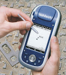
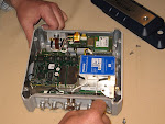
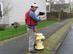
I had my son download three more videos onto my www.ruggedready.com web site. One is on the ProMark 500 survey grade GPS unit. The ProMark 500 gives centimeter accuracy using a real time network such as the one in Oregon or Washington. It's fun to use because you can be collecting centimeter accurate points within minutes of turning it on.
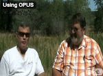
The other two new videos are 1) Using OPUS and 2) What is WGS84? Both of these videos are by Joe Sass and Phil Stevenson with Magellan Professional. They really provide a lot of information in a couple of short videos. Click here to go to www.ruggedready.com Then click on the Survey Grade GPS tab.
Speaking of my son, he just left for a trip to Japan and Taiwan this morning. He'll be gone a month, resulting in my video production coming to a temporary halt. Adam does the filming, video production, and then posts the videos on the web site. I have lots more videos that I want to make, but it will have to wait.
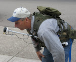
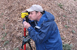
Upcoming conferences include the NW ESRI GIS conference in Sunriver the week of October 13 - 16. I will be exhibiting there, plus I might be a presenter. My presentation, if accepted, will be on using ArcPad to map pond-lilies in Cheadle Lake using a TruPulse 360B. It's an example of a mapping project that would have been difficult, if not impossible, without the TruPulse 360B and ArcPad.
Trivia question: How does the US use 10% of the worlds salt production every year? Answer next week! (It's not "on french fries"!
All for now!
Jon Aschenbach
Subscribe to:
Post Comments (Atom)

No comments:
Post a Comment